


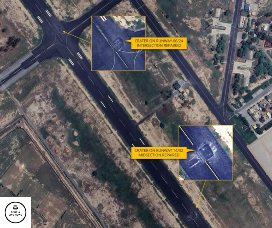
A recent set of satellite images has sparked fresh debate between India and Pakistan, with reports suggesting that a missile may have struck the Kirana Hills — an area long believed to house key elements of Pakistan’s nuclear program.
According to open-source analysts and satellite data circulating online, there appears to be new structural damage in the Kirana Hills region, located in Pakistan’s Punjab province. The site is known for its secrecy and has historical links to Pakistan’s early nuclear research. The speculation gained momentum after certain Indian social media accounts began claiming it was a deliberate missile strike.
However, there’s been no official confirmation from either government. India has not released any statement acknowledging such an event, and Pakistan has remained silent about the claims. This silence has only added to the uncertainty.
Experts in satellite analysis have noted changes in terrain and visible scorch marks in the imagery but caution that such visuals don’t provide conclusive evidence of a missile strike. They could also be a result of controlled demolition, natural activity, or unrelated military operations.
The incident, if true, could mark a serious escalation between the two nuclear-armed neighbors. Both India and Pakistan have had a long history of military and political tensions, especially around issues of territorial integrity and national security.
For now, what’s important is clarity. Accurate information is critical, especially when it involves sensitive nuclear zones. Until both nations provide transparency, these reports will remain speculative — but they do remind us how quickly regional dynamics can shift in today’s world.